
Importance of the covariance function in resource estimation
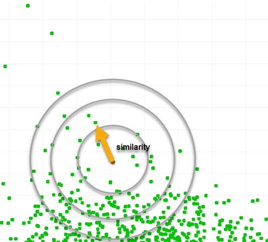
Introduction to resource estimation part 4: importance of the covariance function In our previous post we have demonstrated that estimates are all roughly calculated the same way: multiply a set of weights with either all the known samples (IDW and simple Kriging), or by multiplying the weights with the covariance vector between the known location [...]
Mathematical similarities of Kriging, Implicit Modelling and ML
Introduction to resource estimation part 3: mathematical equivalence of Kriging, RBFs and ML In this post we will show the mathematical similarities and highlight the common factors in three different geostatistical methods: Kriging, implicit modelling and ML. No need to be (very) afraid when quickly scanning the document for all the equations. We have kept [...]
Introduction to resource estimation part 2: From Kriging to Machine Learning
Simple introduction to resource estimation part 2: From Kriging to Machine Learning A more fancy way to create estimates: Kriging Actually, the title should be "A fancy way to estimate the Weights", because in part 1 we demonstrated that the quality of an estimate only depends on the weights we use. So, how do we [...]

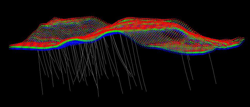
Simple introduction to resource estimation part 1
Simple introduction to resource estimation part 1: fundamentals of geostatistics This post aims to educate geoscientists without or with limited prior knowledge about estimation about the fundamentals of geostatistics. We are aware a whole swath of other methods exist for estimations. However, since geostatistics is now a dominant force in estimation, we will focus on [...]
Multi-element geological data clustering
Multi-element geological data clustering There has been some renewed discussion recently around the topic of domaining: the art of selecting which points should or should not be considered part of a domain.In this regard domaining can be considered a form of clustering. In this post we will explain a novel technique we have developed over [...]
Signed Distance Functions: beyond implicit modelling
Signed Distance Functions: beyond implicit modelling For about two decades now, the industry has been using the term implicit modelling intertwined with the term Radial basis functions (RBFs). It has become the de facto standard and has given people an appreciation of the method compared to explicitly digitizing domains. In the mining industry the [...]
Machine Learning demystified
Machine Learning in geology explained, to better understand how it can be used as part of geological modelling.
3D Fault Model: an example
An example how a 3D faulted geological model can be created in GEOREKA.
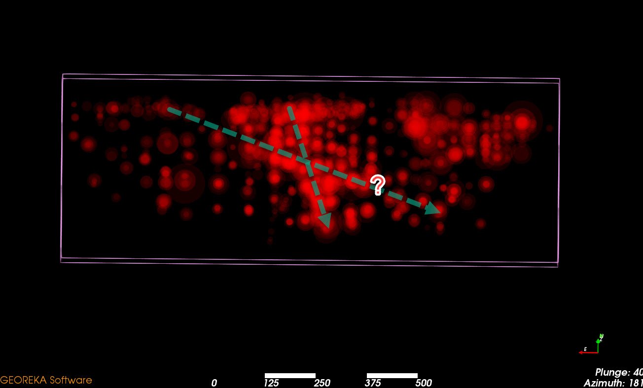
Geological software to help visualizing mineralization trends
Ideas regarding visualization of trends in mineralization
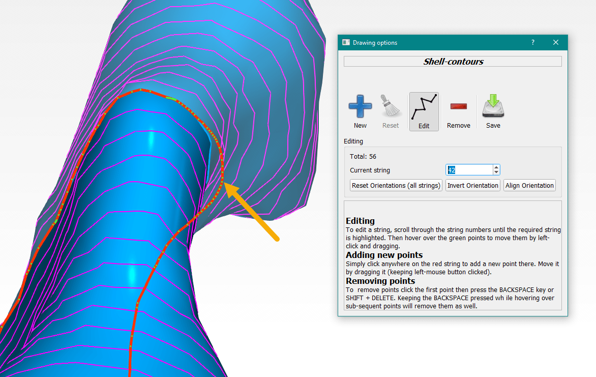
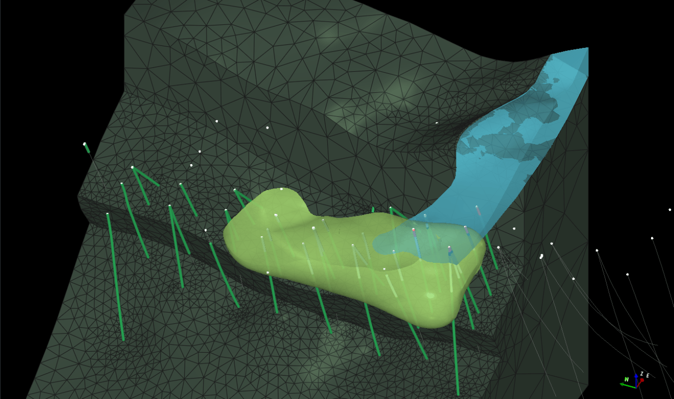
How to edit a (given) grade shell or other surfaces?
A brief article explaining some of the tools to locally edit grade shells based on interpretation or newly available data.