
Geological modelling
CorePremium
GEOREKA is geological modelling software that builds 3D models of orebodies, lithology and structure directly from drillhole data, combining implicit interpolation with explicit control wherever you need it.
Each geological domain is modelled as a true 3D volume rather than a set of stitched boundary surfaces, so models are watertight and domain boundaries are exact. Models are built in a visual, node-based workflow, so when new drilling arrives you re-run the same workflow on the updated data instead of rebuilding by hand. Every modelling tool on this page is included in Core, and the free GEOREKA Viewer lets clients and colleagues open the result.
How a model is built
From drillholes to a finished 3D model
- ImportDrillholes (collar, survey, assay, lithology), topography, CSV, DXF, Leapfrog msh and Lidar, with desurveying and error checking.
- Define domainsInside and outside points from drillholes or manual picks. The Model Descriptor sets how domains relate to each other.
- InterpolateOne implicit function per volume, using machine learning, Kriging or RBFs, with a real-time preview.
- RefineAdd explicit contacts, structural measurements, faults and manual polylines wherever your interpretation should lead.
- OutputTetrahedral grid, triangulated solids or block model, selected with one setting.
IMPLICIT AND EXPLICITCore
Implicit and explicit modelling in one workflow
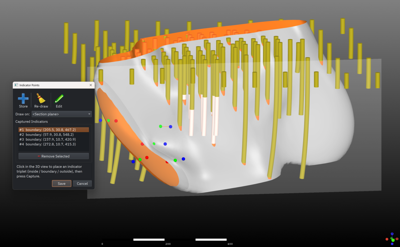
Implicit modelling fits one mathematical function to your drillhole data that describes each domain as a volume. Explicit modelling means digitising contacts and surfaces yourself. GEOREKA uses both: the implicit function does the heavy lifting from inside and outside points, and explicit control overrides it wherever your geological judgement should lead.
- Inside and outside points from drillholes or manual picks
- Machine learning, Kriging or RBF interpolation
- Real-time preview of the implicit function as inputs change
- Explicit contacts, surfaces and polylines for local control
DOMAININGCore
Lithology and orebody domaining, however complex
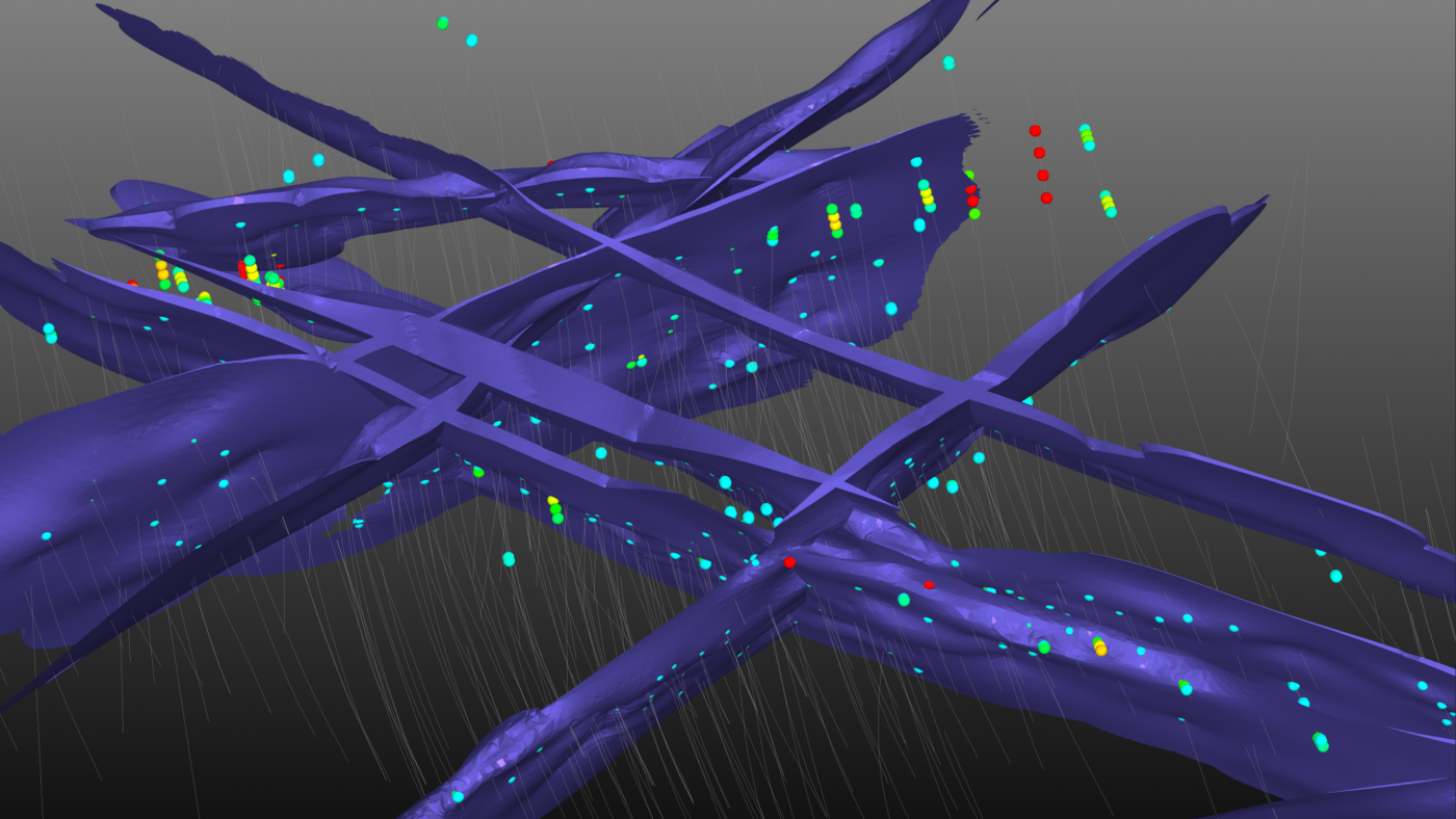
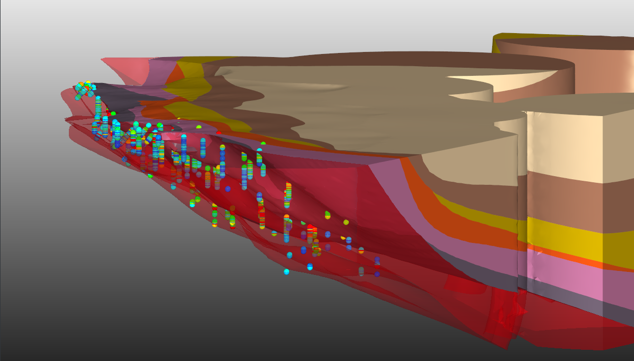
A flexible domain relationship system, the Model Descriptor, defines how domains interact. Simple geology stays simple, and complex geology stays tractable: stratigraphic sequences, intrusions, unconformities, vein systems and dike swarms, and faults with their interactions with domains.
- Every domain is a solid 3D volume from the start, not stitched boundary surfaces
- Watertight models with exact domain boundaries
- Vein systems and dike swarms handled natively
- Fault modelling and fault-domain interactions
STRUCTURECorePremium
Structure from data, not guesswork
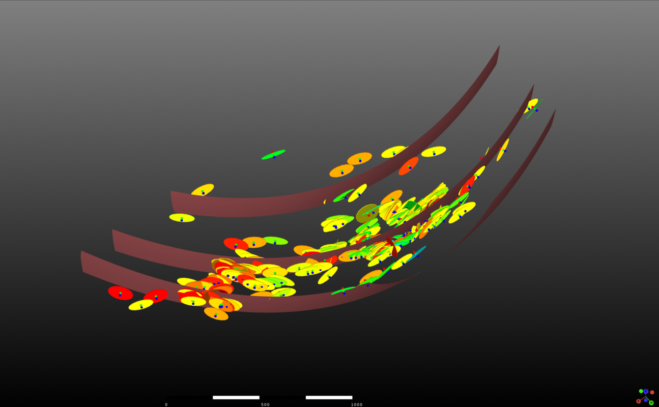
Test whether grades really are correlated to structure by estimating structural orientation from your grade data. Interpolate structural surfaces directly from structural measurements to highlight the main trends, and digitise delicate structures easily and accurately in full 3D.
GEOREKA derives locally varying anisotropy (LVA) from your assay data, so the model follows how the mineralisation really turns and branches, not a single global ellipse. Integration of the LVA field with variography and estimation is part of Premium.
MODEL UPDATESCore
Update the model when new drilling arrives
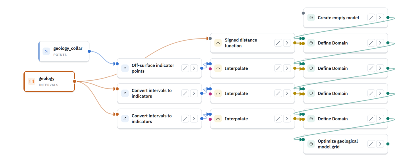
Models are built as a visual, node-based workflow of 80+ items. When new holes arrive, add the data and re-run the workflow instead of rebuilding by hand. Because every step is visible, you decide what updates and what stays fixed. Parallel algorithms with GPU support keep implicit interpolation responsive on large models.
- No hidden parameters
- Selective updating through user-controlled workflow reuse
- Clone and adapt a workflow for a new project in minutes
- Complete audit trail for every model
SUB-DOMAINSCore
Find sub-domains with multi-element clustering
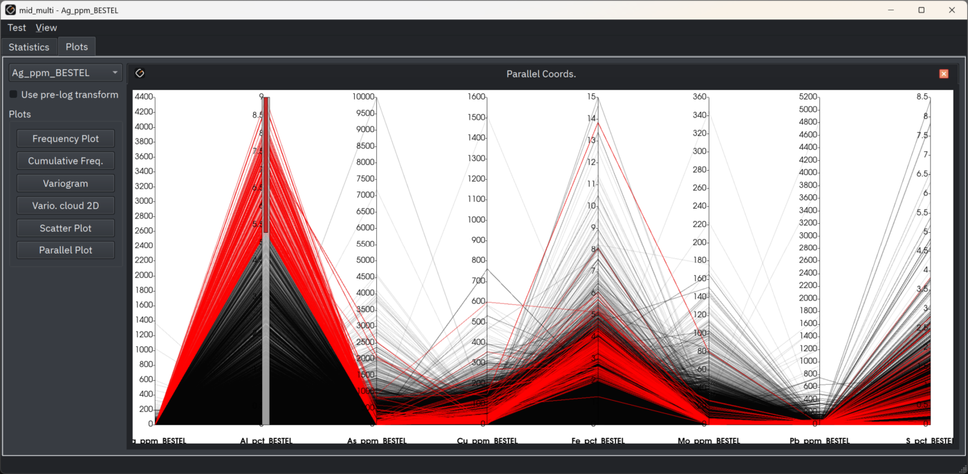
Cluster all your elements at once, combining X, Y, Z with Au, Cu, As, Mo, Pb, Zn and any other assay values, instead of reading one element at a time. Scatter plots link dynamically to the 3D view: select a cluster and watch it light up in space, revealing geochemical halos and sub-domains that single-element analysis can miss.
OUTPUTCore
Models that go where you need them
Choose tetrahedral, solid or block model output with one setting. Tetrahedra conform to domain boundaries, so no sub-blocking is needed. Export blocks, unstructured grids, CSV’s, or triangulated surfaces for use in other packages.
Licence tiers
What is included
Free Viewer
Open and share GEOREKA models and data with anyone, free of charge.
Core
Every modelling tool on this page: implicit and explicit modelling, domaining, structural modelling, workflows, clustering and all outputs. Core also includes basic estimation.
Premium
Everything in Core, plus integration of the LVA field with variography and estimation, the Python console and the MCP connection for automating modelling workflows.
Related
Continue through the workflow
Resource estimation
Statistics, variography, kriging, validation and grade-tonnage results on the same model.
Block modelling
Block, solid or tetrahedral output, populated with grade and interrogated at any cut-off.
Questions
Frequently asked questions
What is geological modelling software?
Geological modelling software builds 3D models of rock units, orebodies and structures from drillhole and other geological data. GEOREKA does this with implicit interpolation and explicit control, and carries the model through to resource estimation in the same application.
What is the difference between implicit and explicit modelling?
Explicit modelling means you digitise contacts and surfaces yourself, section by section. Implicit modelling fits a mathematical function to the data, and the volumes and surfaces follow from it, which makes updates faster and results more repeatable. GEOREKA combines both, so you can override the function wherever your interpretation should lead.
Can I update a model when new drillhole data arrives?
Yes. Models are node-based workflows. Add the new data and re-run the workflow, choosing which parts of the model update and which stay fixed.
Does GEOREKA need sub-blocking?
No. Tetrahedra conform to domain boundaries, so boundaries are represented exactly without sub-blocking. You can still output a regular block model with one setting. Read about block modelling.
Which licence tier includes the geological modelling tools?
All of them are included in Core. Premium adds the full resource estimation suite, the Python console and the MCP connection, and the free GEOREKA Viewer opens and shares the resulting models. The 14-day free trial includes every feature.
Get started
Build your first model in 14 days.
Import your own drillholes and see how the model follows your geology. The trial includes every feature.