
Geological consulting software
CorePremium
GEOREKA is geological consulting software that lets independent and consultancy geologists build 3D models, estimate resources and hand clients a reviewable method, on one licence that moves between clients and projects.
Consulting geologists move between deposits, clients and commodities, and are judged on how defensible their work is. GEOREKA models every domain as a true 3D volume, carries the model through to resource estimation and grade-tonnage reporting in the same application, and records the whole method as a visible workflow that you can reuse on the next deposit and show to a reviewer. Core includes all modelling tools and basic estimation. Premium adds full resource estimation, classification support and reporting for JORC and NI 43-101 deliverables, and clients can open the result in the free GEOREKA Viewer. The Competent or Qualified Person remains responsible for classification and sign-off.
The consulting workflow
How a consulting project runs in GEOREKA
- Import client dataDrillholes, topography, CSV, DXF, Leapfrog msh and Lidar, with desurveying and error checking.
- Build the modelTrue 3D domains from implicit interpolation, with explicit control where your judgement should lead.
- Estimate and validateIDW, RBF and SVR in Core. Kriging, swath plots, cross-validation and simulation in Premium.
- Classify and reportClassification support and grade-tonnage by domain and cut-off, in Premium.
- DeliverThe workflow documents your method, the client opens the model in the free Viewer, and exports go to other packages.
ONE LICENCECore
One licence across clients and projects
A GEOREKA licence is a floating licence, so it is not tied to one client or one project. It can be shared between team members and computers, and there are no activation fees. Take it from one deposit to the next without buying software for each engagement.
Monthly and annual terms let you match the cost of the software to the duration of a project. See the current prices.
REUSABLE WORKFLOWSCore
Reusable workflows between deposits
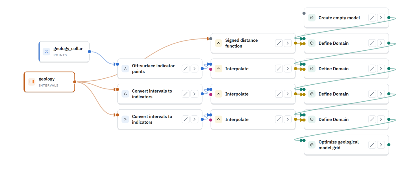
Models are node-based workflows. Clone a workflow built for one deposit, point it at the next client’s data and adapt it in minutes, instead of repeating the same steps by hand. Your method becomes an asset you carry from project to project.
- Clone and adapt a workflow for a new project in minutes
- Selective updating when a client sends new drilling
- No hidden parameters
METHOD RECORDCorePremium
A method record that clients and reviewers can follow
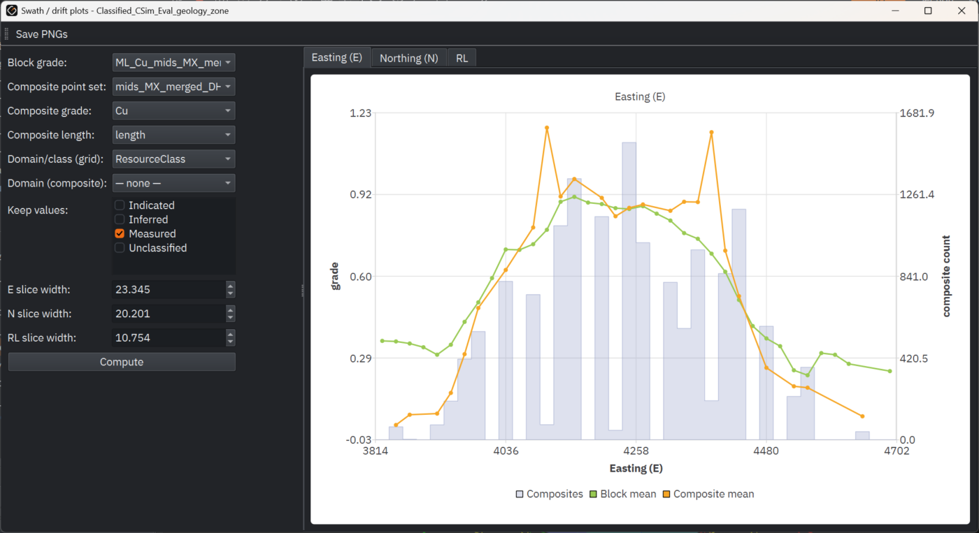
Any result traces back to its input data, and one screenshot of the workflow documents your method from raw drillholes to final model. Premium adds swath plots, cross-validation and conditional simulation, plus drillhole QA/QC for standards, blanks and duplicates: the evidence a peer reviewer asks for.
JORC AND NI 43-101Premium
Reporting-ready outputs for JORC and NI 43-101 deliverables
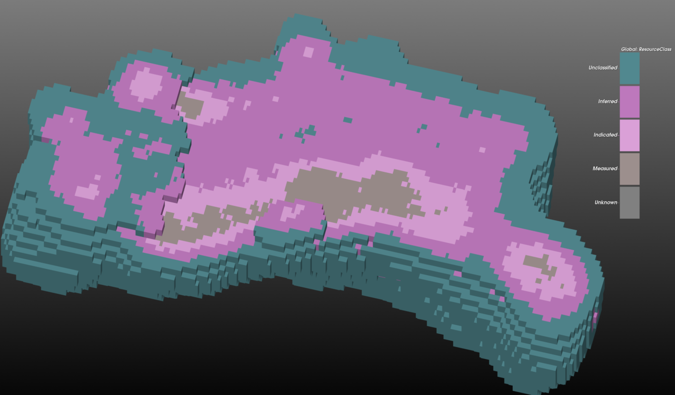
Report tonnage and grade by domain and cut-off, with Measured, Indicated and Inferred classification support, from the same model you estimated on. Classification can follow drill spacing, or the Nyquist–Shannon sampling-adequacy method, which judges the spacing against how continuous the grade is in each domain.
GEOREKA supports the technical work behind a report. It does not certify a resource: the Competent or Qualified Person decides the classification and signs it off.
CLIENT SHARINGFree Viewer
Hand clients a 3D model they can open for free
Share the finished model through the free GEOREKA Viewer, so a client, partner or peer reviewer can explore it in 3D without owning a licence. Export tetrahedral grids, triangulated solids and block models, and triangulated surfaces for pits, tailings dams and landforms, for downstream work.
CLIENT DATACore
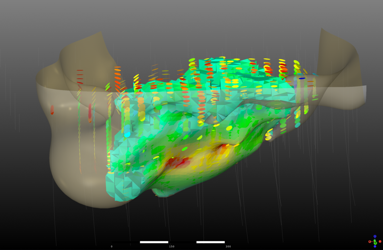
Work with whatever data a client sends
Import drillholes (collar, survey, assay, lithology), topography, and CSV, DXF, Leapfrog msh and Lidar data, with desurveying and error checking built in. Moving from another package? See what switching from Leapfrog Geo involves.
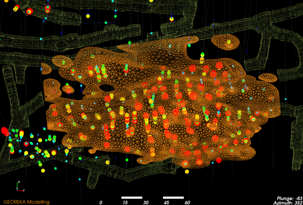
Consultants using GEOREKA
What independent consultants say
“I use GEOREKA for all my wireframe modelling. It is faster and I think the results are more geologically representative than explicit modelling approaches.”
Greg Mosher, independent consultant
“I found GEOREKA back in 2018 when I was desperate for a way to quickly and effectively visualize and manipulate drillhole data in 3D.”
Nathan Bishop, independent consultant
“I have been using GEOREKA for around 18 months. I initially decided to obtain a licence for use in my independent consulting practice.”
Andrew Waltho, independent consultant
Licence tiers
Which GEOREKA tier does a consulting geologist need?
| Tier | What you get | Suits |
|---|---|---|
| Free Viewer | Visualise and share models and data | Letting clients and reviewers open your models |
| Core | All modelling tools and basic estimation (IDW, RBF and SVR) | Geological modelling and first-pass estimates for clients |
| Premium | Everything in Core plus full resource estimation, validation, classification support, reporting, the Python console and the MCP connection | Resource estimates and JORC or NI 43-101 deliverables |
The 14-day free trial includes every Premium feature. See pricing.
Related
Continue exploring
Resource estimation
Statistics, variography, kriging, validation and grade-tonnage results on the same model.
Classification & reporting
Classification support, including Nyquist–Shannon sampling adequacy, and grade-tonnage reporting.
Mineral exploration
First-pass 3D models from sparse drilling, structural controls and fast updates with every new hole.
Questions
Frequently asked questions
What is geological consulting software?
Geological consulting software lets consulting geologists build 3D geological models, estimate resources and document their method for clients. GEOREKA does all three in one application, on a floating licence that can be used across clients and projects.
Can one licence be used across multiple clients and projects?
Yes. A GEOREKA licence is a floating licence, so it is not tied to a client or a project, and it can be shared between team members and computers. Monthly and annual terms let you match the licence to the length of a project.
Does GEOREKA support JORC and NI 43-101 deliverables?
GEOREKA supports the technical work behind them: validated estimates, classification support, grade-tonnage tables and an audit trail from raw drillholes to final numbers. It does not certify a resource or replace the Competent or Qualified Person. Read what GEOREKA does and does not certify.
Can I share a model with a client who does not own GEOREKA?
Yes. The GEOREKA Viewer is free and lets clients, partners and peer reviewers open and explore models in 3D without a licence.
Which GEOREKA tier does a consulting geologist need?
Core covers all modelling tools and basic estimation. Premium adds ordinary (dual) kriging with variography, validation, conditional simulation, classification support and grade-tonnage reporting, which most resource deliverables need. The 14-day free trial includes every feature, so you can test your own workflow before choosing.
Can I reuse a workflow from one deposit on another?
Yes. Models are node-based workflows. Clone a workflow, point it at the new data and adapt it, instead of repeating the steps by hand.
Get started
Try GEOREKA on your own data for 14 days.
Build a model, run an estimate and see how the workflow documents your method. The trial includes every Premium feature.