
Mineral exploration software
CorePremium
GEOREKA is exploration software that turns sparse drilling into 3D geological models, so exploration geologists can see structural controls, test where mineralisation continues and update the model with every new hole.
Exploration geologists work with few drillholes and decisions that cannot wait for the next programme. GEOREKA builds each geological domain as a true 3D volume from drillholes and manual picks, updates the model by re-running the same workflow when new holes arrive, and lets you test whether grades follow structure. Every modelling tool is included in Core, and the free GEOREKA Viewer lets you share the model with partners and investors. When a target matures, the same model carries on to resource estimation in Premium.
The exploration workflow
How to build a 3D exploration model from sparse drilling
- Import and checkDrillholes (collar, survey, assay, lithology), topography, CSV, DXF, Leapfrog msh and Lidar, with desurveying and error checking.
- Build a first modelDomains as 3D volumes from inside and outside points, taken from drillholes or manual picks.
- Test the geologyEstimate structural orientation from grade data, interpolate structural surfaces and derive locally varying anisotropy.
- Find the patternCluster all elements at once and link the plots to 3D to reveal halos and sub-domains.
- Update with new holesRe-run the same workflow when new assays arrive, choosing what updates and what stays fixed.
- Share or advanceShare the model through the free Viewer, or take it on towards a resource estimate.
FIRST-PASS MODELSCore
First-pass 3D geological models from sparse drilling
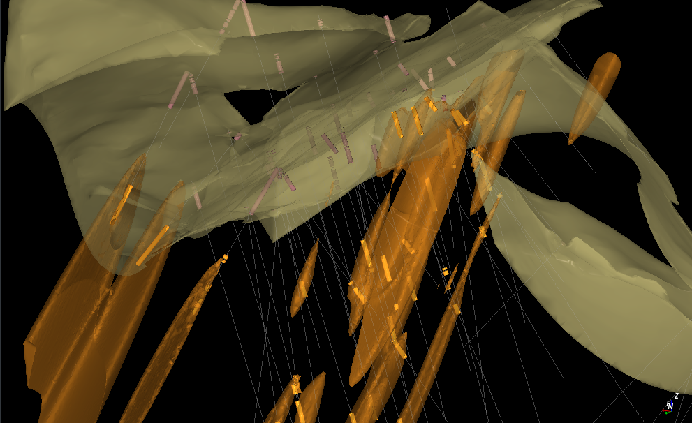
Early-stage projects have few holes and decisions that cannot wait for the next programme. GEOREKA models each geological domain as a true 3D volume from inside and outside points taken from drillholes or manual picks, so you get a first model as soon as there is data to fit. Explicit control, such as contacts and polylines, lets your interpretation lead wherever the data is thin.
- Watertight volumes with exact domain boundaries
- Manual picks and polylines to add geological judgement where holes are few
- Real-time preview of the implicit function as you add inputs
- Vein systems and dike swarms handled natively
STRUCTURE AND CONTINUITYCorePremium
See structural controls and high-grade continuity in your own data
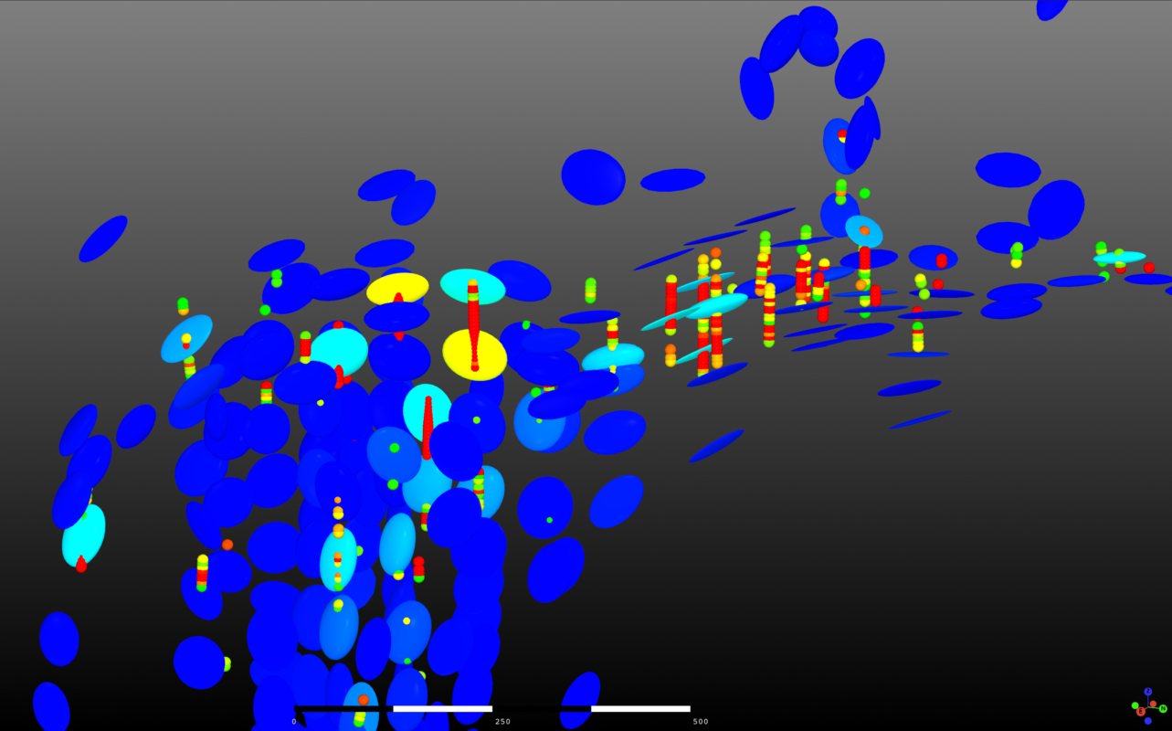
Exploration geologists need to know whether grade follows structure, and which way it continues. GEOREKA estimates structural orientation directly from your grade data so you can test the link, and interpolates structural surfaces from structural measurements to show the main trends.
Locally varying anisotropy (LVA) captures how the mineralisation turns and branches, so the model follows its true orientation instead of a single global direction. Folded and branching mineralisation is not forced into one trend. Integration of the LVA field with variography and estimation is part of Premium.
MULTI-ELEMENT ANALYSISPremium
Multi-element clustering and linked plots to sharpen targets
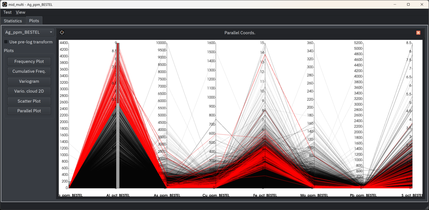
Cluster all your elements at once, combining X, Y, Z with Au, Cu, As, Mo, Pb, Zn and any other assay values, instead of reading one element at a time. Select a cluster in a scatter plot and it lights up in the 3D view, which can reveal geochemical halos and sub-domains that single-element analysis misses.
Use what you see to decide where to step out and where to infill.
MODEL UPDATESCore
Update the model with every new drillhole
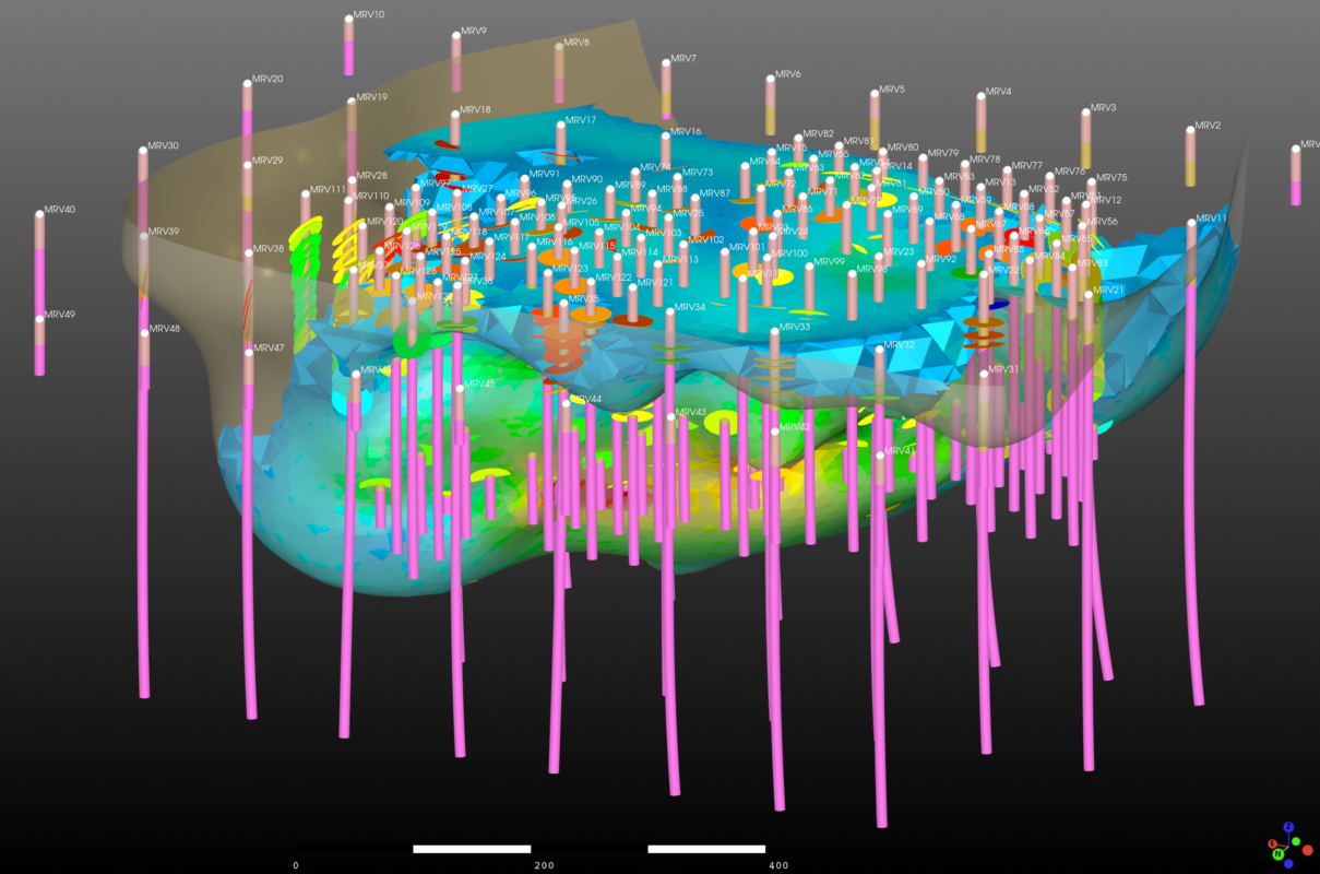
Models are built as a visual, node-based workflow. When new assays arrive, add the data and re-run the workflow instead of rebuilding by hand, and choose which parts of the model update and which stay fixed. Every step is visible, so a colleague, partner or reviewer can follow how the model changed.
- No hidden parameters
- Selective updating through user-controlled workflow reuse
- Clone a workflow for the next project in minutes
SHARINGFree Viewer
Share exploration models free with the GEOREKA Viewer
Send the model to a joint-venture partner, a director or an investor, and they explore it in 3D without a licence. The free GEOREKA Viewer is a stand-alone application for visualising and sharing models and data.
TO RESOURCECorePremium
From exploration target to resource estimate, in the same model
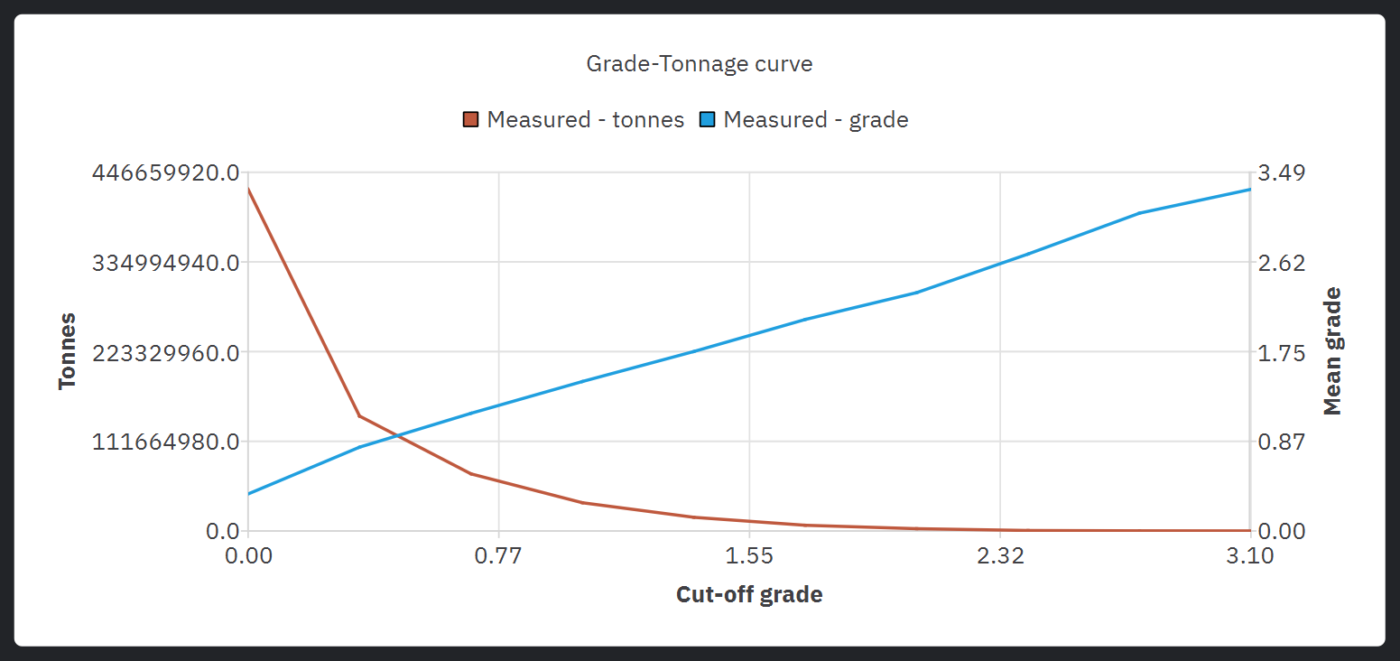
When a target matures, you do not start again. Core includes basic estimation (IDW, RBF and SVR) with real-time tonnage and grade at any cut-off. Premium adds ordinary (dual) kriging with full variography, validation, conditional simulation and classification support, so the exploration model grows into a resource estimate in the same application.
Built for the team you have
Built for how exploration teams work
Easy to learn
A visual workflow shows every step, and the 14-day free trial includes every feature, so you can model your own data before you decide.
Bring your existing data
Import drillholes, topography, CSV, DXF, Leapfrog msh and Lidar. Moving from another package? See what switching from Leapfrog Geo involves.
Predictable licensing
Floating licences, monthly or annual, shareable between team members and computers, with no activation fees.
Licence tiers
Which GEOREKA tier suits an exploration project?
| Tier | What you get | Suits |
|---|---|---|
| Free Viewer | Visualise and share models and data | Showing results to partners and investors |
| Core | All modelling tools and basic estimation (IDW, RBF and SVR) | Building, testing and updating exploration models |
| Premium | Everything in Core plus full resource estimation, the Python console and the MCP connection | Moving a mature target towards a resource estimate |
The 14-day free trial includes every Premium feature. See pricing.
Customer experience
What exploration geologists say
GEOREKA is intuitive and user-friendly, which has made it easy for our team, including new members, to get up to speed quickly. The software’s exceptional visualization capabilities and flexible workflow have significantly enhanced our decision-making processes across various project types. Ramin Rafiei – Novamera Inc.
Related
Continue exploring
Geological modelling
Implicit and explicit workflows, true 3D domains, structural modelling and fast model updates.
Resource estimation
Statistics, variography, kriging, validation and grade-tonnage results on the same model.
Consultants
One licence across clients and projects, reusable workflows and reporting-ready outputs.
Questions
Frequently asked questions
What is exploration software?
Exploration software helps geologists turn drillhole, structural and geochemical data into 3D models that show where mineralisation is and which way it continues, so they can plan the next drilling. GEOREKA does this with implicit and explicit modelling, structural analysis and multi-element clustering, and it can carry the model on to resource estimation.
Can I build a 3D geological model from only a few drillholes?
Yes. GEOREKA builds each domain from whatever inside and outside points you have, from drillholes or manual picks, and explicit control lets your interpretation lead where the data is thin. A model from few holes is only as well constrained as the data, so add structural measurements where you can and update the model as holes arrive.
How do I update an exploration model when new drillholes arrive?
Models are node-based workflows. Add the new data and re-run the workflow, choosing which parts of the model update and which stay fixed.
How does GEOREKA help find drill targets?
GEOREKA does not pick targets for you. It shows where your data says mineralisation continues: locally varying anisotropy shows the direction of continuity, structural analysis tests whether grades follow structure, and multi-element clustering highlights geochemical halos and sub-domains. Those views help you decide where to step out or infill.
Can I go from an exploration model to a resource estimate in the same software?
Yes. Core includes basic estimation (IDW, RBF and SVR). Premium adds ordinary (dual) kriging with variography, validation, conditional simulation, classification support and grade-tonnage reporting, all on the same model. Read about resource estimation.
How much does exploration software cost?
GEOREKA is licensed as floating licences (monthly or annual) in two paid tiers, Core and Premium, and the GEOREKA Viewer is free. The 14-day trial includes every feature. See the current prices.
Get started
Model your own exploration data in 14 days.
Import your drillholes and see how the model follows your geology. The trial includes every feature.