

MINING GEOLOGY SOFTWARE
Geological modelling · Resource estimation
GEOREKA is mining geology software that takes exploration geologists and geological consultants from drillhole data to 3D geological models and resource estimates, in one application.
Build domains as true 3D volumes, estimate grade directly on the model, and carry the result through to grade-tonnage reporting without exporting to a second package. GEOREKA comes in three tiers: the free GEOREKA Viewer to visualise and share models, Core with the complete geological modelling toolkit and basic estimation, and Premium with full resource estimation, including geostatistics, validation, classification support and reporting. Geological modelling is visual by nature, so each capability comes with a short demo of the real workflow.
The GEOREKA workflow
From drillhole to resource statement
Each stage is further explained its own page. All stages run on one model in one application, so nothing has to be exported, re-imported or rebuilt between steps.
Free ViewerVisualise and share models CoreAll modelling tools plus basic estimation PremiumFull resource estimation, Python and MCP
Geological modelling
Implicit and explicit workflows, true 3D domains, structural modelling and fast model updates when new drilling arrives.
Resource estimation
Exploratory statistics, variography, kriging, validation and grade-tonnage results, on the same model you built.
Block modelling
Block, solid or tetrahedral output with one setting, populated with grade and interrogated at any cut-off.
Visualisation
Real-time 3D, sections through any plane, linked plots, and free sharing through the GEOREKA Viewer.
Classification & reporting
Classification support and grade-tonnage reporting, with a clear account of what GEOREKA does and does not certify.
Capabilities
What is in each tier
01 — DOMAINSCore
Domains as true 3D volumes
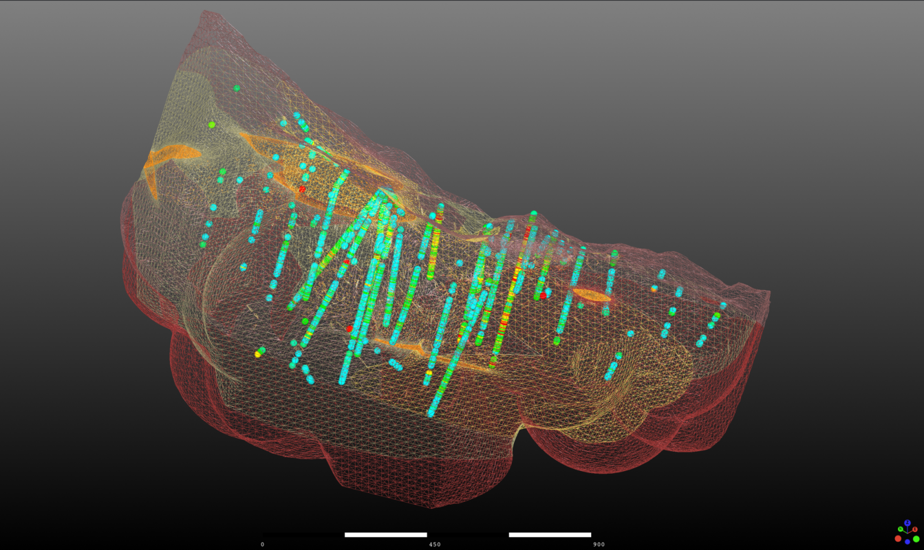
Every geological domain is a solid 3D volume from the start, not a set of boundary surfaces stitched together. Give GEOREKA inside and outside points from drillholes or manual picks and it fits one implicit function that describes the whole volume, with explicit control wherever you want it. Flexible domain relationships handle simple and complex geology alike, including vein systems and dike swarms.
- Watertight models with exact domain boundaries
- Tetrahedra conform to the boundaries, so no sub-blocking
- Switch between tetrahedral, solid and block model output with one setting
- Direct export for geotechnical, geophysics and flow simulation
Watch demo: implicit domain modelling · 0:00
02 — ANISOTROPYCorePremium
See which way the mineralisation really runs
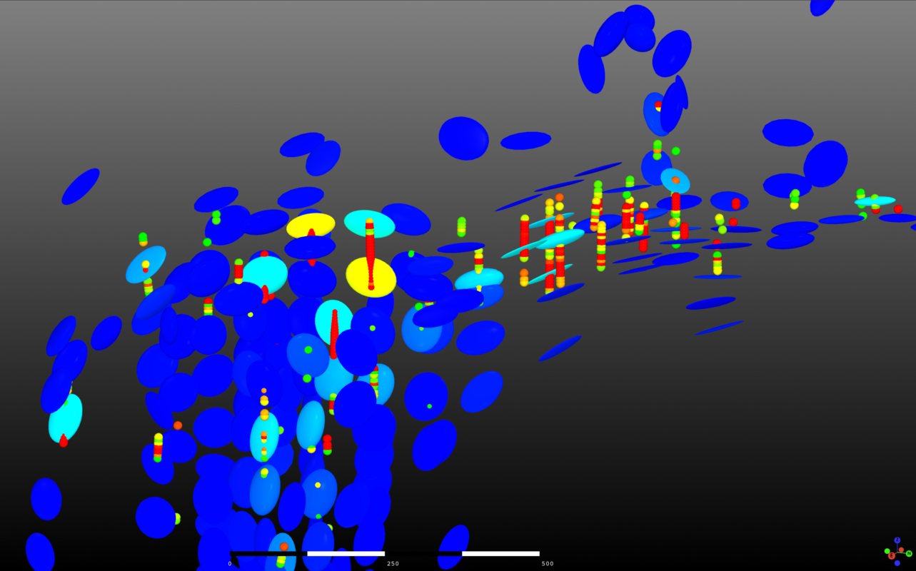
GEOREKA derives locally varying anisotropy (LVA) directly from your assay data. The LVA field is not just displayed: it drives the domains, the variograms and the numbers you report. Your model follows the true orientation of the mineralisation, not a single global ellipse.
- Orientation is captured locally, so folded and branching mineralisation is not forced into one direction
- Structural controls and high-grade continuity become visible in your own data
- Integration with variography and estimation is part of Premium
Watch demo: LVA-driven modelling · 0:00
03 — STRUCTURECore
Structure from data, not guesswork
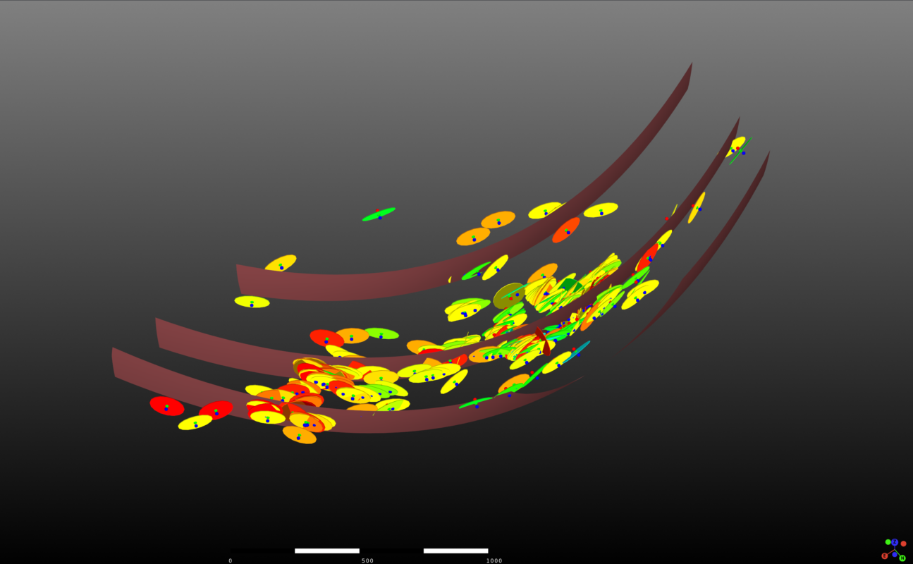
Test whether grades really are correlated to structure by estimating structural orientation from your grade data. Interpolate structural surfaces directly from structural measurements to highlight the main trends, and digitise delicate structures easily and accurately in full 3D.
04 — WORKFLOWSCore
Every step visible, editable, reusable
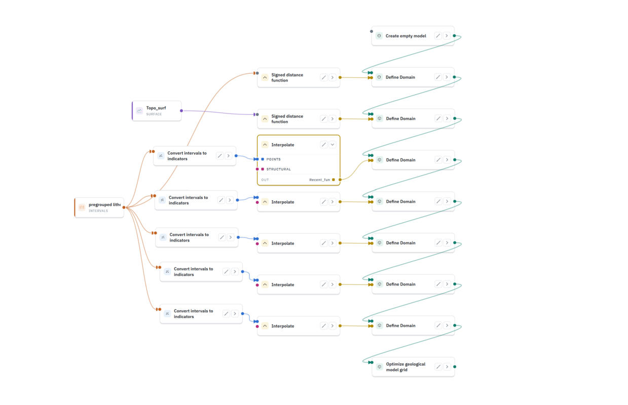
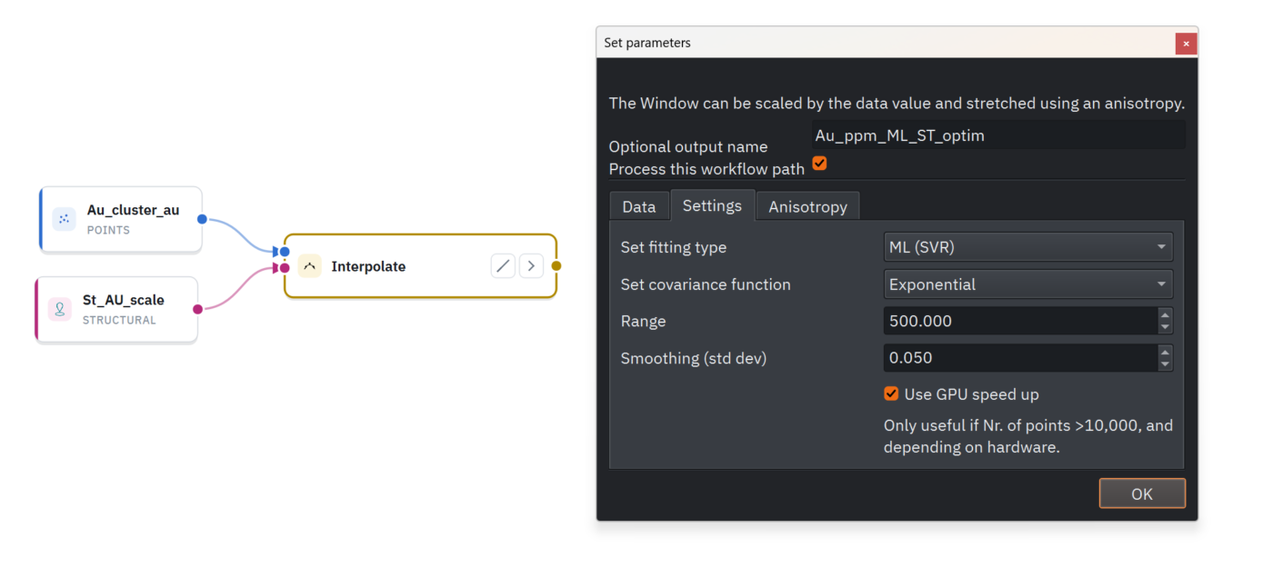
Build your model as a visual, node-based workflow with 80+ items. Any result traces back to its input data, and the whole process can be reused on a new dataset. One screenshot documents your entire method for a reviewer, from raw drillholes to final model. That matters for reproducibility, and for anyone reviewing to JORC or NI 43-101.
- No hidden parameters
- Clone and adapt a workflow for a new project in minutes
- The workflow is its own methodology report
Watch demo: node-based workflows · 0:00
How GEOREKA supports resource classification and reporting →
05 — ESTIMATIONCorePremium
Compare every method, side by side
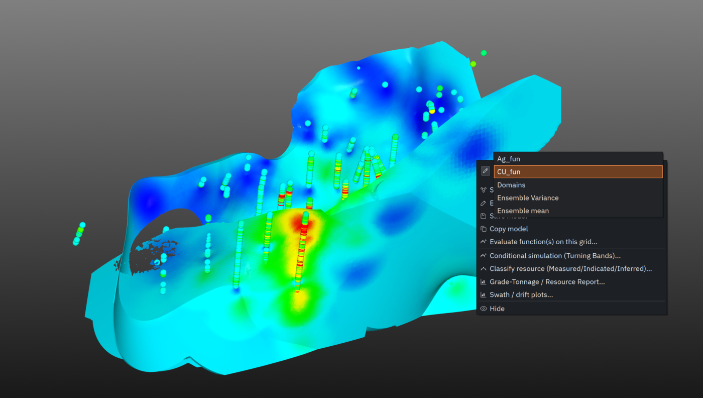
IDW, RBF and ML regression are built into GEOREKA’s modelling engine, with Ordinary Kriging and full variography in Premium. View two estimation results at once in the 3D window with real-time cut-off adjustment, and read tonnage, grade and volume for any cut-off straight from the information panel. Evaluate on regular grids or directly on the geological model for volume-weighted grade averages.
Watch demo: side-by-side estimation · 0:00
06 — RESOURCESPremium
From estimate to resource statement
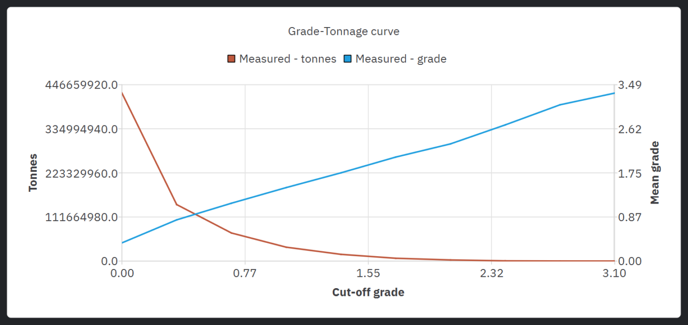
Premium adds the complete geostatistics and resource reporting suite to the same application and the same model, with no export, no second package and no extra module.
- Exploratory data analysis and declustering
- Variography with anisotropy fitting
- Kriging Neighbourhood Analysis
- Estimation validation: swath plots and cross-validation
- Conditional simulation
- Grade-tonnage reporting by domain and cut-off, with Measured / Indicated / Inferred classification support
- Drillhole QA/QC: standards, blanks and duplicates
Watch demo: resource reporting · 0:00
07 — ANALYTICSCore
Plotting, linked to 3D
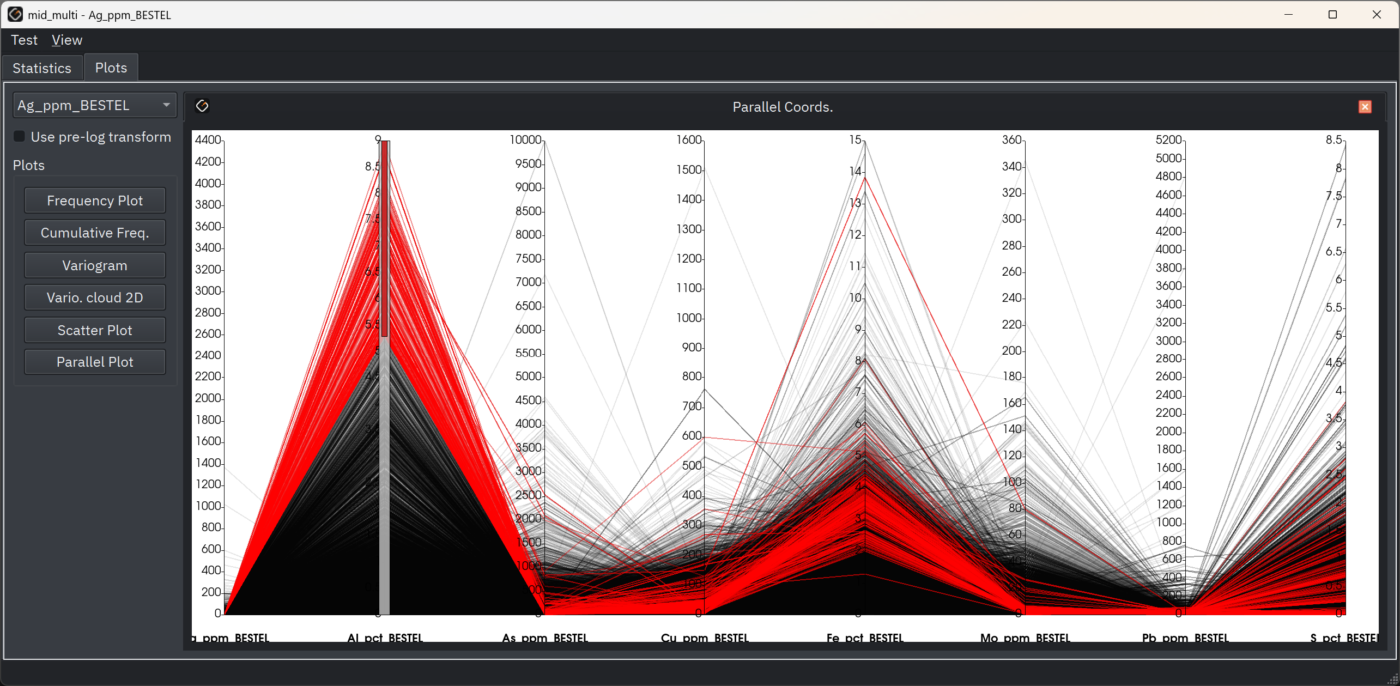
Cluster all your elements at once, combining X, Y, Z with Au, Cu, As, Mo, Pb, Zn and any other assay values, instead of reading one element at a time. Scatter plots link dynamically to the 3D view: select a cluster and watch it light up in space, revealing geochemical halos and sub-domains that single-element analysis can miss.
Watch demo: machine learning workflows · 0:00
08 — PERFORMANCECorePremium
Parallel algorithms with GPU support
The current release runs most optimised algorithms in parallel, with GPU support for the heavy lifting: implicit interpolation, variography, estimation and real-time visualisation. Large models and full-scale deposits stay responsive, so you spend your time interpreting geology instead of waiting for the software.
Watch demo: large-model performance · 0:00
09 — DATA & OUTPUTCore
Data in, models out
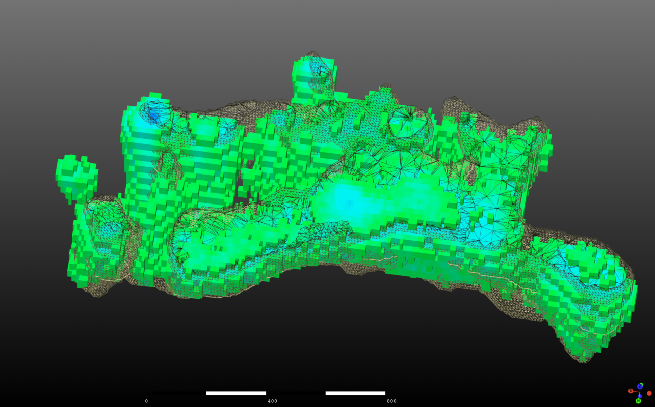
Import drillholes (collar, survey, assay, lithology), topography, and CSV, DXF, Leapfrog msh and Lidar data, with desurveying and error checking built in. Export tetrahedral grids, triangulated solids and block models for tonnage and volume work, plus triangulated surfaces for mine pits, tailings dams and landforms. Real-time raytracing helps you present geological structures with precision.
Block models and tetrahedral output →
Moving from another package? See what switching from Leapfrog Geo involves.
10 — AUTOMATIONPremium
Python and MCP: automate it, or just ask
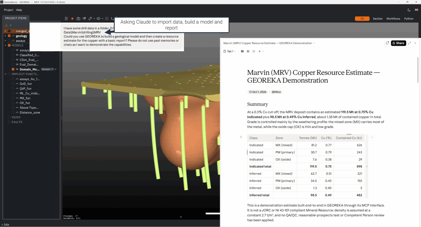
A built-in Python console runs loadable scripts, so you can automate routine tasks, build company-specific workflows and connect your own data pipeline. The MCP connection goes further: link your preferred LLM or AI agent and let it operate GEOREKA in natural language, across the whole platform from import and domain modelling to structural interpretation, estimation, plotting and reporting. Every action runs through the same workflows you use manually, visible and auditable in the live 3D scene.
Watch demo: MCP & AI agents · 0:00
Complete reference
All features at a glance
Show the full feature list
Data management
- Drillhole import: collar, survey, assay, lithology
- CSV and standard formats, including DXF, Leapfrog msh and Lidar
- Desurveying (minimum curvature)
- Drillhole data error checking
- Manual polyline digitising
- Topography surface import
- Multiple data sets per project
- Compositing and sample management
- Drillhole QA/QC: standards, blanks and duplicates (Premium)
Geological modelling
- Implicit modelling with machine learning, Kriging or RBFs
- Traditional explicit modelling (contacts, surfaces)
- Domain relationship system (Model Descriptor)
- Vein systems and dike swarms
- Fault modelling and fault-domain interactions
- Stratigraphic sequences, intrusions and unconformities
- Tetrahedral mesh generation with optimisation
- Block models and triangulated solids
- Watertight model construction
Estimation & analysis
- Inverse Distance Weighting (IDW)
- Radial Basis Function (RBF) interpolation
- Machine learning regression
- Ordinary (dual) Kriging, with full variography (Premium)
- Exploratory data analysis and declustering (Premium)
- Kriging Neighbourhood Analysis (Premium)
- Swath plots and cross-validation (Premium)
- Conditional simulation (Premium)
- Grade-tonnage reporting and classification support (Premium)
- Multi-element similarity clustering
- Dynamic 2D/3D plot linking
- Interactive cut-off analysis and method comparison
Visualisation
- Real-time preview of implicit functions
- Dynamic cross-sections through any plane
- Adjustable transparency and cut-offs
- Drillhole display with interval colouring
- Surface rendering (triangulated, implicit)
- Grade shell visualisation
- Real-time raytracing
- High-resolution export for reports
Workflows & automation
- Visual node-based workflow editor (80+ items)
- Reusable workflow templates
- Complete audit trail for every model
- Selective updating of models through user-controlled workflow reuse
- Python console with loadable scripts (Premium)
- MCP connection for LLMs and AI agents (Premium)
Licensing & sharing
- Floating licence, monthly or annual
- Shareable between team members and computers
- Free stand-alone geology viewer
- Academic licences available
- 14-day full-functionality free trial
- No activation fees
- Free Viewer, Core and Premium tiers
- No separately paid modules
Questions
Frequently asked questions
What is GEOREKA?
GEOREKA is mining geology software for exploration geologists and geological consultants. It builds 3D geological models from drillhole data and carries them through to resource estimation and grade-tonnage reporting in a single application.
What is included in Free Viewer, Core and Premium?
The free GEOREKA Viewer visualises and shares models and data. Core adds all modelling tools plus basic estimation (IDW, RBF and machine learning regression). Premium adds full resource estimation: ordinary kriging with variography, validation, conditional simulation, classification support and grade-tonnage reporting, plus the Python console and MCP connection. See the pricing page for the tier comparison.
Is there a free version of GEOREKA?
Yes. The GEOREKA Viewer is free and lets you visualise and share models and data. Read more about visualisation and the Viewer.
Can I try the full software before buying?
Yes. The 14-day free trial includes every Premium feature, with no limitations, so you can import your own data and build a model before choosing a tier.
What data can I import and export?
Import drillholes (collar, survey, assay, lithology), topography, and CSV, DXF, Leapfrog msh and Lidar data, with desurveying and error checking built in. Export tetrahedral grids, triangulated solids and block models, plus triangulated surfaces for pits, tailings dams and landforms.
Get started
Try every feature for 14 days — no limitations.
Import your own data, build a 3D model and see how it follows your geology. The trial includes every Premium feature.